


Technology advances to better serve professionals working in demanding field environments. Juniper Systems is no exception. From rugged handheld upgrades to GNSS high accuracy receivers and intuitive mapping software, Juniper continues to deliver tools that transform how work gets done in manufacturing, GIS, utilities, field service, and beyond. In this blog, we’re highlighting the best of the best, continually empowering users to work effectively and with fewer interruptions.
Archer™ 4 Rugged Handheld


Improve efficiency with a durable device with real-time data collection. Featuring a 6.25-inch display that easily fits in your pocket, the Archer 4 is a versatile option for frequent data entry. The optional GNSS Pod provides 1 meter accuracy and optional RTK activation gives 2 cm accuracy. This data collection device supports navigation services GPS, GLONASS, Beidou, and QZSS.
Working in manufacturing and supply chain management? We’ve got you covered. From inbound processing to shipping and distribution, Archer 4 empowers users to complete tasks quickly and effectively. The optional Android handheld barcode scanner and data collection services help reduce manual entry errors and speed up operations. And the enhanced speed and longevity of the Octa-core Qualcomm processor minimizes interruptions.
The Archer 4 is Google Mobile Services Certified to run the most popular data collection applications and supports upgrades through Android 18. This versatile handheld is ready to handle any task the manufacturing process throws at it.
Geode™ GNSS Receiver

No more inconvenient antennas and wires – the Geode contains the receiver, antenna, and battery in an all-in-one lightweight construction. The Geode is a precision mapping-grade GNSS receiver, enabling accurate, real-time positioning with sub-meter, sub-foot, decimeter, and optional RTK centimeter accuracy. Available now with Galileo High Accuracy, this GPS receiver offers precision and reliability for GIS data collection. The Geode offers a variety of accessories, including the Geode Grip which turns your Geode and data collection device of your choice into a single handheld solution, a backpack strap kit, and a survey pole to further improve mobility and flexibility. With these accessories, the Geode is ready for GIS utility mapping, delivering performance and convenience in one robust package.
Mesa® Pro Rugged Tablet

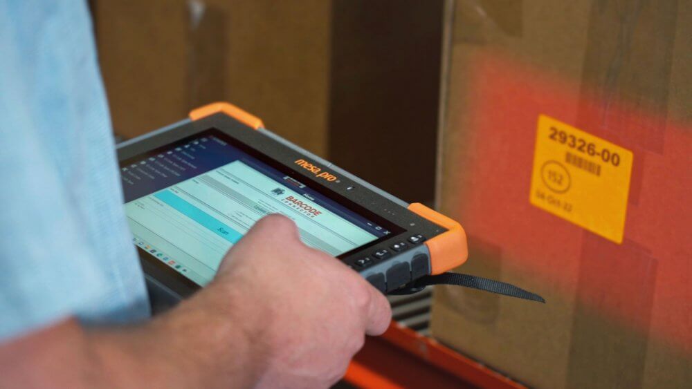
The Mesa Pro Rugged Tablet is a powerful laptop replacement for those in need of a large 10-inch screen on the go. Input data, communicate with others in real-time, and upload spreadsheets. This Windows rugged tablet is designed with an ultra-durable construction, ensuring it can endure the bumps, drops, and spills that are common in rough environments. Available with expansions and accessories that improve processes such as: RFID inventory management and barcode scanner, tablet vehicle mount, and keyboard.
The Mesa Pro runs on Windows 11 and has a sunlight-readable display and impressive processing power. Its rugged design includes an IP68 rating for protection, repelling elements such as dust, rain, and debris. This Windows rugged tablet can also afford to get beaten up with its aluminum rigid core with bumpers for shock-proof resilience and MIL-STD-810 performance standards, safe from drops, shock, and extreme temperatures. Built to order, these rugged devices are a must-have in the rugged tablet market.
Uinta™ Mapping and Data Collection Software

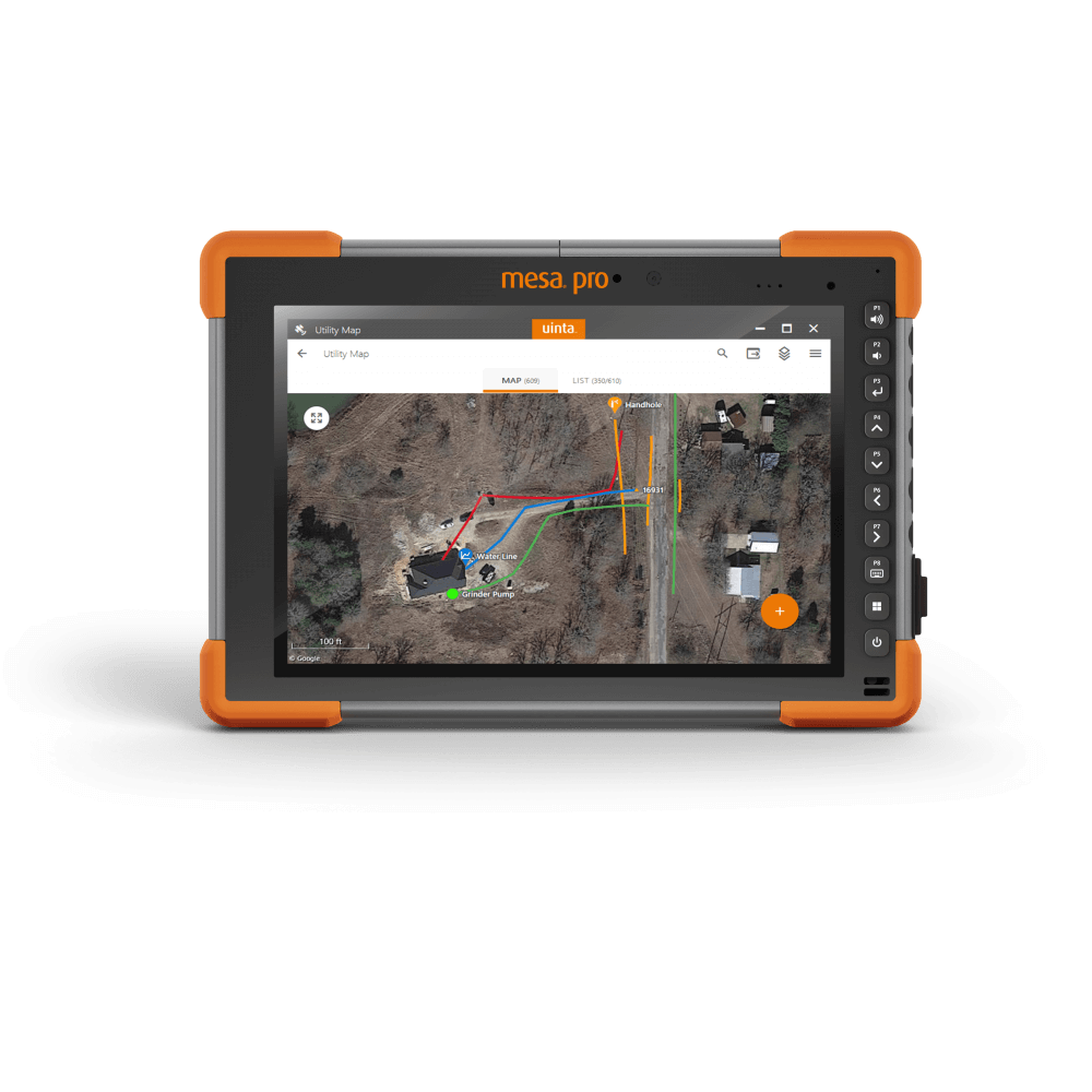
Uinta software is a simple and easy-to-use mapping software and data collection service. Designed with a user-friendly interface, Uinta offers a streamlined experience for those creating and sharing projects out in the field. Customize templates related to the job, map points with satellite imagery maps, and share data across different platforms. Eliminate the need for paper-based processes by sharing mobile mapping projects with your field users electronically, choosing templates, and easily sharing field-collected data via Microsoft Excel, ESRI Shapefiles, Google Earth, and professional PDF map exports.
Whether you’re mapping utilities, managing supply chain logistics, or collecting data in remote locations, these tools are built to keep up with the toughest jobs. As technology continues to evolve, one thing remains constant: the need for reliable, field-tested solutions that deliver results.
Juniper Systems is a leading manufacturer of ultra-rugged tablets, rugged handheld computers, GPS receivers, GIS mapping software, and field computing solutions. Professionals utilize Juniper Systems’ innovative mobile computers in natural resources, utilities and public services, geospatial, agriculture, industrial, and military markets. Visit our website to see how Juniper Systems’ rugged solutions meet all your rugged computing needs.