

What does SBAS stand for?
SBAS stands for satellite-based augmentation system.
What is SBAS?
SBAS is a regional network of ground and satellite system that works to boost the accuracy and dependability of GPS and GNSS data. The increased accuracy is critical for aviation and is widely used by the geospatial industry for increased accuracy in navigation and mapping.
How does SBAS work?
SBAS uses stationary land-based GNSS monitors to calculate GNSS position errors caused by atmospheric and ionospheric disturbances, satellite orbit errors, and inaccurate clocks. Each of these errors causes delays in timing, which result in position errors for a receiver.
To calculate GNSS position errors, GNSS data from satellites are compared against the precisely documented locations of each land-based monitor. Any discrepancy is determined to be an error. Corrections to the errors are sent to geostationary satellites and broadcast throughout the region. These SBAS corrections – called deviation corrections – allow GNSS receivers to more accurately and reliably determine their position.
GNSS is normally accurate to around five meters. Using SBAS, users can achieve an accuracy of two meters or better. Some receivers can apply SBAS corrections with additional techniques to achieve sub-meter or better accuracy.
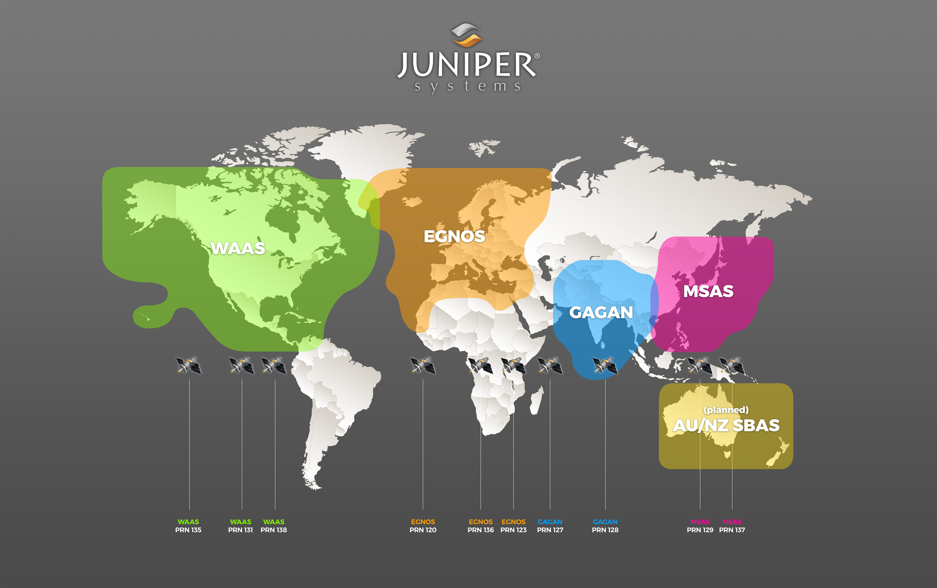
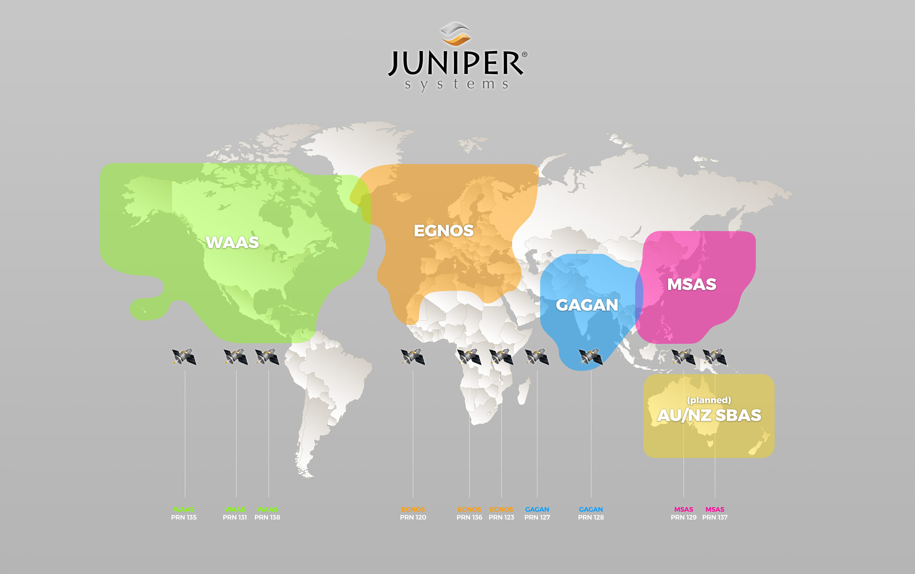
What regions have SBAS coverage?
WAAS United States, Canada, Mexico: Wide Area Augmentation System, or WAAS, is operated by the United States Federal Aviation Administration. Development for WAAS began in 1994.
EGNOS European Union: European Geostationary Navigation Overlay Service, or EGNOS, was developed by the European Space Agency.
MSAS Japan: The Multi-Functional Satellite Augmentation System, or MSAS, is operated by the Japan Civil Aviation Bureau, a division of the Ministry of Land, Infrastructure, and Transport.
GAGAN India: GPS-Aided GEO Augmented Navigation, or GAGAN, was developed by the Indian Space Research Organization and Airport Authority of India.
What SBAS systems are under development?
SNAS China: Satellite Navigation Augmentation System, or SNAS, is in development.
SDCM Russia: System for Differential Corrections and Monitoring, or SDCM, is in development. When completed, SDCM will offer corrections for GPS and GLONASS, the Russian satellite navigation system.
WADGPS South Korea: Wide Area Differential Global Positioning System, or WADGPS, is in development.
Download free SBAS coverage maps here
Dark background
Light background

Juniper Systems’ Geode Sub-meter GPS Receiver is an affordable GPS receiver, accurate within a meter with SBAS corrections, that provides real-time data to decision makers. It’s rugged for data collection in harsh environments. To learn more about the Geode, contact us here. Visit Juniper Systems online.