


Our team had an awesome time exhibiting at INTERGEO in Frankfurt, Germany on October 7-9! With over 500 other companies exhibiting and an estimated 18,500+ attendees, we had hundreds of GIS professionals come speak with us about our solutions meeting their needs. All the GIS experts that stopped by the booth were given an early look at our next GNSS receiver, Spire, as well as our current solutions that we showcased. Let’s get into why professionals are so enthusiastic about our newest receiver and our other powerful GIS solutions!
Spire…Coming Soon!
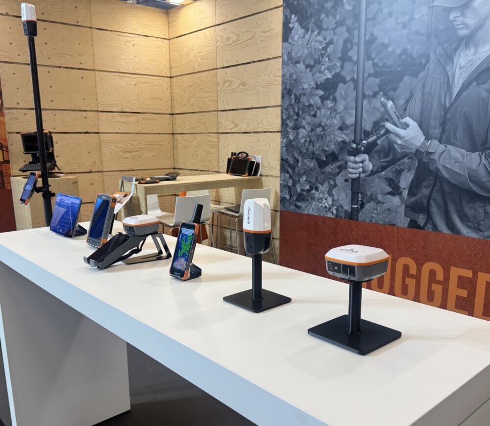
Spire, our newest lightweight precision GNSS receiver, gained the attention of professionals at INTERGEO that stopped by the booth to get a first look for themselves. Coming in early 2026, Spire expands Juniper Systems’ GIS offerings so you can find the right hardware for your needs. For mapping solutions that just work, stay tuned for more information on Spire to know more about its capabilities with determining your Location, Simplified.
Geode: Your Location, Our Solution.
The Geode GNSS Receiver remains a favorite amongst GIS professionals needing an easy-to-use and lightweight solution for their data collection needs. Attendees were drawn to its scalable accuracy options that include SBAS, RTK, Atlas, and Galileo High Accuracy Service, as well as its all-day battery life, compact design, and Juniper Rugged™ construction, enabling it to handle harsh environments with ease. Another favorite feature is its ability to pair with most iPhone®/iPads®, Android™, and Windows® devices, as well as being compatible with popular GIS software, making it easy to integrate into existing workflows and equipment.

Uinta: Your Data. Your Way.
Attendees looking for customizable forms and a success team that helps them get started were enthusiastic about our Uinta Mapping and Data Collection Software. It is a flexible, field-ready solution for teams needing an intuitive way to capture and manage spatial data collected in the field, even when offline. Uinta allows users to easily create custom mapping projects, collect geotagged photos, take notes, and sync that data with their teams. Attendees also loved Uinta’s ability to export data into other GIS systems, allowing them to maintain their existing workflows.
Archer 4 w/ GNSS Pod: Sub-Inch accuracy with RTK
INTERGEO attendees needing an all-in-one data collection solution built for tough conditions really liked the capabilities of the Archer 4 w/ GNSS Expansion Pod! It’s a powerful combination of a rugged handheld having an optional GNSS pod for reliable centimeter-level RTK positioning. It’s the go-to choice for demanding field work, with its sunlight-readable display, glove-friendly touchscreen, all-day battery life, IP68 water rating, and MIL-STD-810H durability. Having an Android operating system, the Archer 4 supports a wide range of mapping and data collection apps from the Google Play Store, allowing GIS teams to work with familiar systems.

Rugged Computing
Along with our geospatial solutions, Juniper Systems offers rugged handhelds from 6.26-inch screens up to 10-inches and can handle drops on hard surfaces or submerged in water with their MIL-STD-810H rating. The Mesa 3 and Archer 4 run on Android, while the Mesa 4 and Mesa Pro run on Windows, giving you a choice of operating system. Handling any task or environment you put them through; you can focus on finishing the job and not on your equipment.
Key Takeaways
It was a pleasure meeting everyone at INTERGEO 2025 and we are humbled by all the interest we received in our GIS solutions, especially with our newest receiver, Spire. It’s always great to connect with professionals from around the world and show them how Juniper Systems’ solutions will enhance their work and overcome obstacles. Don’t forget to stay tuned for more to come with Spire as we get closer to launch, and if you have any questions our Team is always here to help you stay Rock Solid and Field Ready!