There are a variety of GNSS correction services available to meet the needs of mobile workers around the world. While GNSS systems and receivers today are very accurate and reliable, the basic system design of a GNSS constellation delivers only a limited accuracy without the aid of additional correction services. Choosing the correction service that accomplishes the mapping and data collection expectations of a particular job can be challenging without an understanding of its capabilities. In this article, users can learn the benefits and limitations of various correction services available today. Many GPS/GNSS receivers are compatible with these services; here we use the Geode GNSS Receiver by Juniper Systems as an example.
SBAS
Satellite-Based Augmentation Systems, or SBAS, are free regional correction services that professionals can use with GNSS receivers that support them. It successfully provides a live satellite broadcast that can be received anywhere within the coverage area of the SBAS service. SBAS improves GPS position calculations by providing ionospheric corrections to the L1 signal of GPS satellites. The ionosphere is the largest source of error that affects GNSS satellite position accuracy. SBAS correction can resolve from an autonomous solution, anywhere between three to five meters or more, down to less than a meter. With a Geode GNSS Receiver, users can get down to a corrected solution of 60 centimeters or under two feet.

It’s important to note that SBAS are regional services and not available worldwide. SBAS signals are broadcast from geostationary satellites and are in a fixed position in the sky. The signal of SBAS can be obstructed by structures such as buildings, trees, and hillsides. SBAS tries to mitigate this issue by using more than one telecommunication satellite to provide multiple positions in the sky to improve signal reception. GNSS receivers also store the correction in the receiver, so intermittent interruptions are tolerated.
SBAS is a smart choice for general mapping with minimal cost investment.

NTRIP
NTRIP stands for Network Transportation of RTCM data via Internet Protocol. NTRIP is a common method used by RTK or CORS networks to deliver real-time corrections to GNSS receivers. A Geode receiver can use data from a Real-Time Network to calculate a “float” solution, the first part of an RTK solution, to deliver position accuracy within a few inches. This is a real-time differential solution. Using a single-frequency Geode, users can get around 30 centimeters of accuracy using a real-time network. Using a multi-frequency Geode, users can use this solution to get an accuracy of 15 centimeters. This is an instantaneous solution that allows users to receive their data more efficiently than SBAS.
The Geode can use network corrections from this internet-based service. Getting this data from these real-time networks requires using the Geode Connect software or another application and an internet connection to connect to a network and decode the messages for the receiver.

Users can get corrections from this service that may be better than the SBAS service. Users need to be aware that RTK/CORS networks typically broadcast their correction service data in different datums and coordinate reference systems depending on their location or region.
Some limitations include the network being managed and configured in diverse ways, requiring a device that can connect to the internet, and generally covering smaller regions. In addition to these limitations, users should consider that this service may or may not have subscription costs that vary.
This is a good precision solution that allows users to use local networks and internet connectivity. It is particularly useful for areas where satellite-based corrections could be interrupted.
Atlas
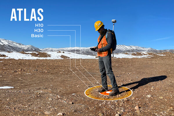
Atlas is a satellite-based or “L-Band” global correction service. Atlas provides nearly worldwide coverage, from 70 degrees north to south latitude. It is a Precise Point Positioning or “PPP” correction service. An advantage of a PPP-based service is users do not have to connect to another network or receiver. This service is particularly useful in remote areas where network or internet-based correction services are not accessible. Atlas is a subscription service that can be purchased for various amounts of time and accuracy. It is a licensed correction service for individual receivers. Atlas has three different accuracy options for users to choose from: Atlas Basic, Atlas H30, and Atlas H10 (50 cm, 30 cm, and 8 cm, respectively).

The limitation of PPP corrections is convergence time. Convergence is the time it takes for a receiver to resolve accurate positions, as a PPP solution requires many calculations to be made over time. The higher the level of accuracy, the longer the initial convergence time required to achieve the target accuracy. Once converged, the receiver can tolerate intermittent signal interruptions. Because it is satellite-based, users are subject to similar limitations as SBAS.
Atlas is a great option for remote areas where other correction services are unavailable.
Post-processing
GNSS data from the Geode can be post-processed using the appropriate data capture and processing software. OnPOZ Mobile, by Effigis, is an app that can capture GNSS data for post-processing. Post-processing is a correction method that involves capturing the desired data with a “rover” receiver and combining it later with known or “base station” data in software to process out the errors. It’s a very accurate methodology to gather high-quality data.
The primary limitation of this is that users don’t know how good the data is until it is processed. Meaning it can require users to go back out into the field if previous observations did not deliver the desired accuracy, or if data for post-processing was not available for that day.
Still have questions?
There are several different correction services available. Each provides advantages based on the time, place, and budget allocated for a project. Choosing the correction service that gets users a better position for the type of work being performed is essential to save time and maximize resources. For additional information and guidance on correction services, please contact our team of experts.

