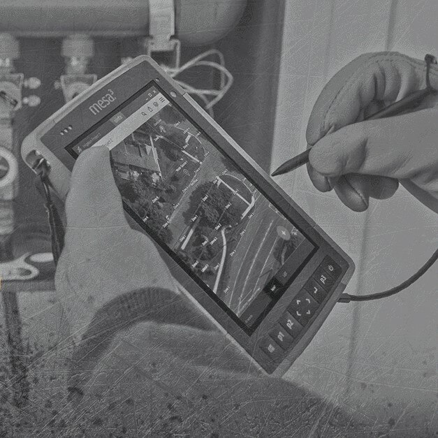
Uinta™ Mapping and Data Collection Software by Juniper Systems is a powerful hassle-free data collection software. Professional mapping can be done by anyone when they have the right tools.
Uinta was designed to offer a simple, yet powerful mapping tool for users. Out of the box, Uinta is equipped to deliver a professional mapping experience. A simplified user interface allows data collection to begin as soon as the application is loaded and entire teams can be trained in minutes.
For a complete mapping solution, Juniper offers the Mesa® Rugged Tablet running Windows 10 and the Geode™ Sub-meter GPS Receiver along with Uinta.
Uinta is currently available on the Windows® platform and will work on most desktops, laptops, and tablets running Windows 10. An Android version of the software is coming soon.
Uinta’s top features include:
- Efficient Data Capture
Replace paper forms with efficient electronic data entry forms, for use with or without maps. - Professional Mapping
Quickly map points, lines, and areas. High-accuracy mapping supported. - Customizable
Create custom project templates so field-collected data reflects your job(s). - User-friendly
A simple interface allows users to be trained and begin collecting data in minutes. - Sharable
Export data to a file, print professional PDF map reports, and create optional cloud projects. - Free & Live Support
Get a jump start on your project with help from Juniper Systems’ in-house customer success team.
Easily customized to meet industry needs
Uinta is easily customized to meet the mapping needs of any user in virtually any industry. Using Uinta for mapping in the commercial irrigation space is no different. Through custom templates, mapping irrigation and sprinkler assets is easy, visually appealing, and efficient.
By default, Uinta is set up to map simple lines, points, and areas. With custom templates, Uinta can be set to allow for these generic mapping functions to represent any piece of equipment or item.
Uinta for commercial irrigation mapping
With an irrigation-specific Uinta template, users can map typical irrigation features, such as valves, control heads, main lines, laterals, and zones. Uinta works as a powerful tool to map as-builts and to perform surveys of broken irrigation assets or water audits.
For example, the irrigation template in the screen below represents how Uinta can be customized to meet job requirements. In this example, multiple point types have been created to assist in the mapping of irrigation projects. The same can be done to represent waterlines, laterals, or zoned areas.

The best part about all this? All the templates currently available for Uinta can be further customized to fit any organizational needs. Proper names or internal language can be inserted in the place of generic terms. Names, point types, lines, or zone options can be trimmed down to just the ones that apply to the current project. This allows for a clean, easy-to-use interface.
Use Uinta to plan, bid, map existing as-builts, and perform maintenance
Uinta can be used in every phase of irrigation and sprinkler mapping. Quickly plan and map out new sprinkler systems for customers and use that information to submit bids to land the job. Once a job is completed the maps can then be used for performing maintenance on the system at future dates.
Taking on a new job with an existing irrigation system? Uinta can help map existing as-builts to provide users the information they need to take on any new maintenance or building jobs.
Uinta allows for professional PDF map reports to be shared with customers. These reports can include equipment lists, maintenance notes, and photos. These reports allow for clear communication and show customers what is being bid, mapped, or maintained on their property.

See what our customers are doing with Uinta
Juniper has several commercial irrigation customers using Uinta for their bidding, mapping, and maintenance needs. Below are some examples of the types of projects that these companies are using Uinta for.

Project details:
All County Irrigation, out of New Jersey, is managing a large condominium HOA irrigation system with 70 Controllers. The HOA already had an existing system and All County Irrigation was responsible for surveying the existing systems to determine what repairs were needed and to see what changes could be made to the system. All County utilizes Uinta, the Mesa Rugged Tablet, and the Geode Sub-meter GPS Receiver in the field to collect mapping data.
Once the current system was surveyed, All County Irrigation was responsible for doing the work and updating the HOA’s system. Because the HOA is so large, All County references their Uinta generated maps to understand the as-builts while at a particular controller and to plan improvements.

Project details:
Fieldstone Landscape of Clearwater, Florida used Uinta to survey a huge townhome development. Their work included plans for new sprinkler systems, tree removal, and ongoing maintenance.
Fieldstone customized their Uinta template to include many layers that include points for control boxes, valves, trees, and sprinkler heads. They utilized zones to map grass areas and lines to visualize the as-built systems on the property. They also used the export function within Uinta to export multiple reports to be included with their bids to stakeholders in the project.
See how Uinta can fit your irrigation, landscaping, and sprinkler mapping needs
Reach out for a tour around Juniper Systems’ Uinta software for irrigation. Free product demos of both hardware and software are available. Whether it’s just the Uinta software or a complete solution with the Mesa Rugged Tablet, Geode Sub-meter GPS Receiver, and Uinta, our world-class customer success team is there for you all along the way. Use the link below to reach out.


