Geospatial

Cedar Products, Data collection software, Geospatial, Industrial, Partners

Try Cedar Android Handhelds with TerraGo Edge

Try Cedar Android Handhelds with TerraGo Edge

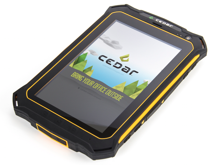
Juniper Systems recently joined up with TerraGo®, provider of geospatial collaboration and enterprise mobility software, to combine our Android®-operated Cedar rugged handhelds with TerraGo Edge, a mobile GPS collaboration platform.

February 17, 2016 ×

Archer 2 Rugged Handheld, Customer stories, Data collection software, Geospatial, Natural resources, Rugged handhelds

The North Face & National Geographic Attempt Southeast Asia’s Highest Peaks

The North Face & National Geographic Attempt Southeast Asia’s Highest Peaks

You may remember a blog post we wrote a while back about an American expedition team that ventured to the peak of Myanmar’s never-before-climbed Mount Gamlang Razi, in an effort to record its elevation and (hopefully) establish it as the new highest peak in Southeast Asia.

August 25, 2015 ×

Archer 2 Rugged Handheld, Data collection software, Geospatial, Partners, Rugged handhelds

FREE Surveying Software with Archer 2 Purchase

FREE Surveying Software with Archer 2 Purchase

Australian Global Technologies (AGT), a new Juniper Systems partner, is now offering either their Pocket Surveyor or Field Surveyor software, FREE when you buy an Archer 2™ through an AGT reseller.

January 27, 2015 ×

Data collection software, Geospatial, Natural resources, Partners, Rugged handhelds

GNSS Accuracy and Influencing Factors

GNSS Accuracy and Influencing Factors

Ken Lucas, an engineer technician with the Nevada Division of Water Resources, recently tested the Archer 2™’s GNSS accuracy—with both GPS & GLONASS receivers enabled—when used with OnPOZ EZTag CE™ mobile software from Juniper partner, Effigis. Typically, the Archer 2 experiences 2-5 meter GNSS accuracy, but when used with OnPoZ […]

November 17, 2014 ×

Data collection software, Geospatial, Natural resources

Webinar Recording – Achieve Sub-Meter GPS Accuracy On a Budget

In case you missed our webinar last week: “Achieve Sub-Meter GPS Accuracy On a Budget,” you can watch the recording here: Thanks to everyone who attended! We had a great turnout and a lot of great questions. If you’d like to learn more about this easy, inexpensive solution for sub-meter […]

September 30, 2014 ×

Data collection software, Geospatial, Natural resources

Last Chance to Register for Our Webinar TODAY!

Last Chance to Register for Our Webinar TODAY!

Our webinar: Achieve Sub-Meter GPS Accuracy On a Budget, will start in just a few short hours, so hurry and register now if you haven’t yet! In the webinar, Juniper Systems’ GIS experts will demonstrate how to: 1) Easily collect field data using EZTag, an inexpensive GIS-mapping software packed with […]

September 25, 2014 ×

Data collection software, Geospatial, Natural resources

Upcoming Webinar: Achieving Sub-Meter GPS Accuracy on a Budget

Upcoming Webinar: Achieving Sub-Meter GPS Accuracy on a Budget

Juniper Systems invites you to an upcoming webinar: Achieving Sub-Meter GPS Accuracy on a Budget. In the webinar, our GIS experts will demonstrate how easy it is to: Collect field data using EZTag CE™, an inexpensive GIS-mapping software packed with functionality Achieve sub-meter accuracy on collected data with a simple […]

September 19, 2014 ×

Customer stories, Data collection software, Geospatial, Natural resources

Data Management Keeping German Forests Sustainable

Data Management Keeping German Forests Sustainable

The forest service in the state of Hessen, Germany, known as the Hessen-Forst Enterprise, manages close to 1.7 million acres of forested land, and is one of the most influential forest services in Europe. You’ll understand why in a minute.

August 29, 2014 ×