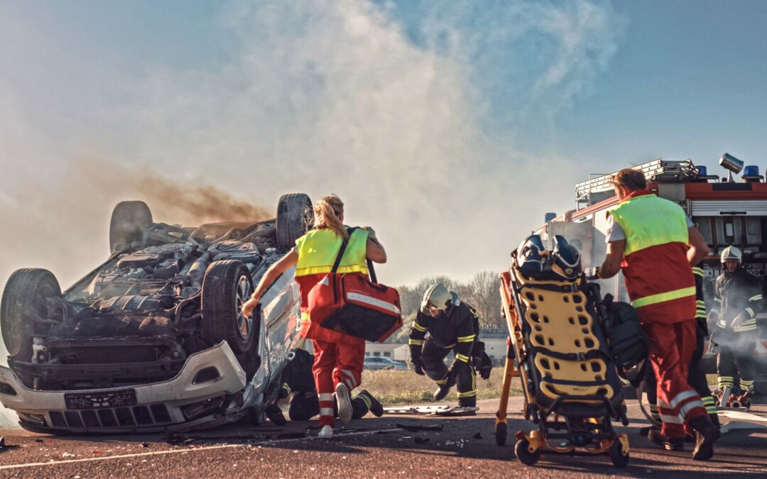
Geospatial

Customer service, Data collection software, Geospatial, Helpful information

Windows Mobile/WEHH Memory Usage Trick on ArcPad

Windows Mobile/WEHH Memory Usage Trick on ArcPad

One thing you may have found while using Windows Mobile or Windows Embedded Handheld is that the operating system has a 32 MB limit on RAM memory used per process. In Esri®’s ArcPad field mapping software, this means that any process such as panning/zooming, mapping, opening/closing layers, etc. is limited […]

May 2, 2014 ×

Archer 2 Rugged Handheld, Archer 3 Rugged Handheld, Data collection software, Geospatial, Helpful information

JSNav: An Easy-to-Use GNSS App

JSNav: An Easy-to-Use GNSS App

The Archer 2 comes with a new, easy-to-use GNSS app called JSNav, which replaces the older GPS Compass app and includes additional functionality and features. While most of our customers use third-party software to collect their data, JSNav is useful because it gives users a feel for the Archer 2’s […]

April 22, 2014 ×

Archer 2 Rugged Handheld, Geospatial, Helpful information, Rugged handhelds

GNSS Receivers: This One Trick Will Make All the Difference

GNSS Receivers: This One Trick Will Make All the Difference

If you’ve ever worked with GNSS (Global Navigation Satellite System) receivers, then you know that not all receivers are created equal. GNSS receivers can vary greatly both in terms of accuracy, as well as reliability. Check out these images for instance:

April 16, 2014 ×

Archer Field PC, Customer stories, Geospatial, Natural resources

Gamlang Razi – Setting the Elevation Straight

Gamlang Razi – Setting the Elevation Straight

Last September, a team made up of American and Myanmar climbers set out to climb Gamlang Razi, the 2nd highest peak in Southeast Asia which has never been before climbed—in an attempt to prove that it was actually the highest, as well as to promote friendship between the two countries.

January 29, 2014 ×

Geospatial, Industry happenings

The Future of Mobile Technology for Geomatics Professionals

The Future of Mobile Technology for Geomatics Professionals

  Juniper Systems Ltd. General Manager Simon Bowe was recently interviewed by GeoConnexion about where mobile technology currently stands in the geomatics industry, and where it is going. Simon answers questions like:

January 10, 2014 ×

Archer 2 Rugged Handheld, Geospatial, Helpful information

A Look at the Archer 2’s Bluetooth® – You May Be Surprised

A Look at the Archer 2’s Bluetooth® – You May Be Surprised

When people ask us about the Bluetooth® in Juniper Systems’ products, sometimes they ask, “Why does your range specification seem short?” or “Just how much range can I get when I connect it to my _____?” The Archer 2’s Bluetooth is labeled as “Bluetooth Wireless Technology, 2.1 +EDR, Class 1.5” […]

November 22, 2013 ×

Data collection software, Geospatial

Webinar TODAY – free & low-cost GPS software options

Webinar TODAY – free & low-cost GPS software options

Join us TODAY at 11AM-12PM MDT for a webinar on free and low-cost GPS software options available for data collection. We only have a few spots left, so register now! Register Now

October 17, 2013 ×

Data collection software, Geospatial, Mesa Rugged Notepad

Free App to Improve GPS Signal Accuracy

Free App to Improve GPS Signal Accuracy

For those of you who have used GPS out in the field, you know it can be frustratingly difficult to get an accurate GPS signal when you’re working in a challenging environment. Towering trees, looming skyscrapers, and deep canyons can all cause big problems for your GPS signal accuracy. When […]

August 8, 2013 ×