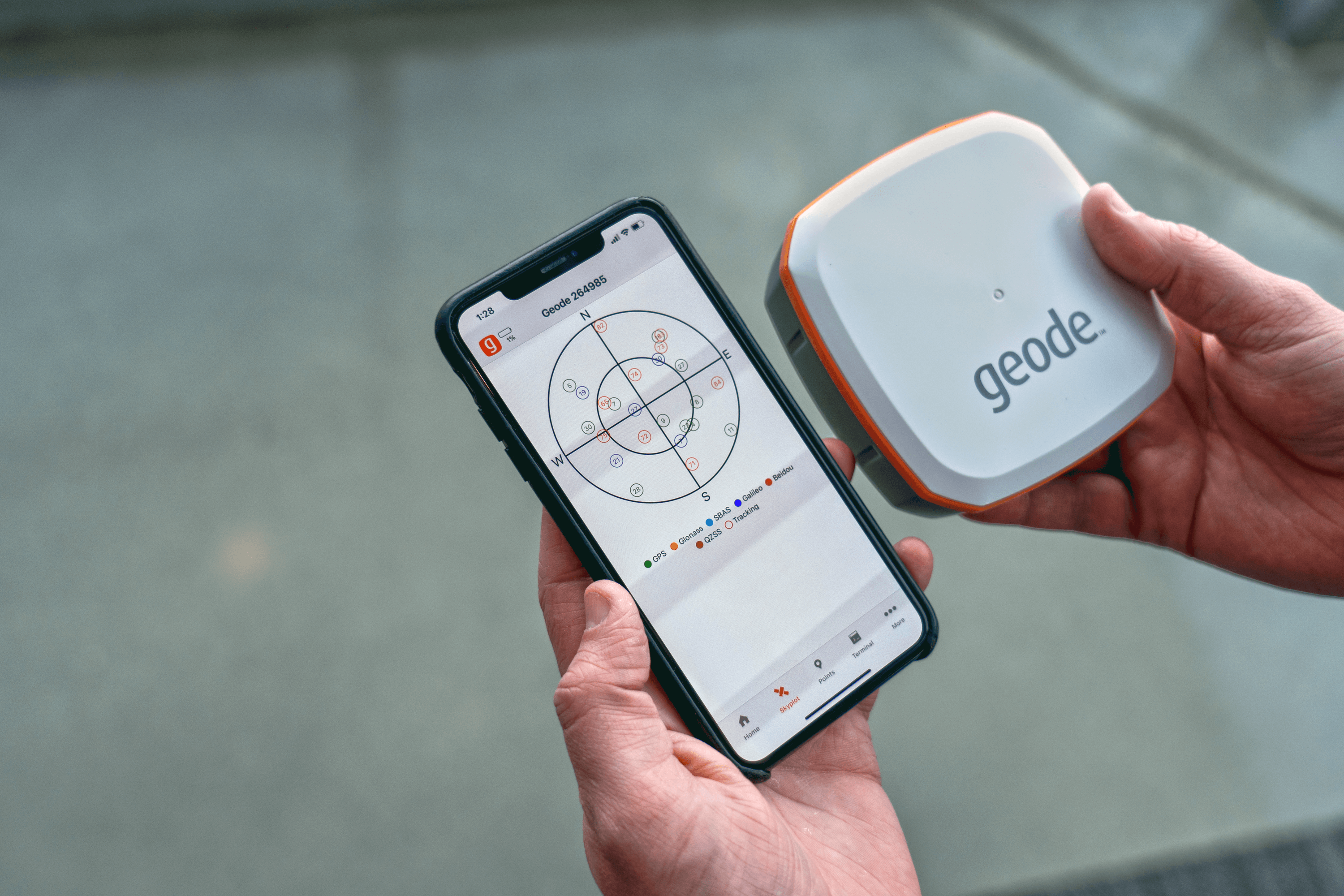
The launch of the all-new Geode GNS2 Real-time Sub-meter GPS Receiver brought some exciting new features to the Geode product line. This was headlined by an MFi certification through Apple®. Being an MFi-certified device allows the Geode to connect via Bluetooth ® directly to compatible iPhone® or iPad® devices (you can read more about this here). Since its launch, the response has been incredible by application developers. Developers have been updating their mapping software and applications to take full advantage of the sub-meter GPS power of the Geode while using an Apple device.
Esri®, a global leader in GIS, mapping, and location software, recently updated its catalog of ArcGIS® applications for iOS to take full advantage of the sub-meter accuracy of the Geode GNS2. These applications include Collector for ArcGIS, Survey123 for ArcGIS, QuickCapture for ArcGIS, and AppStudio Player for ArcGIS. Each application found within the ArcGIS platform offers unique and powerful tools for users. Updating these applications to take full advantage of the sub-meter accuracy of the Geode allows for a complete data collection solution on an Apple device.
What do these app updates mean for users?
These updates allow for greater use of the features found in the Geode GNS2. Once the Geode is connected to an Apple device it replaces the internal GPS built into the device. This means users need only follow a simple process of connecting the Geode as a Bluetooth device, and the positional accuracy for all apps is improved. When an application needs to display additional data beyond the basic information provided by Location Services such as NMEA data, accuracy information, users may connect to our Geode Connect companion app, which provides a host of settings and control features for the Geode, including NTRIP corrections connectivity.
Which Esri apps were updated?
Update 2021 – Field Maps for ArcGIS is Esri’s latest field data collection and mapping application. Field Maps is a single application designed for accomplishing many data collection and mapping functions that in the past was completed with several different applications. Key features of Field Maps include, viewing maps, offline work, advanced search functions, use with professional-grade GPS receivers (like the Goede), and easy to use forms just to name a few.
Collector for ArcGIS is a powerful data collection application that allows users to easily mark and add points of data to existing data maps or create new projects. Easily download maps and work offline. The application features data collection of points, lines, areas, and other related data. Easily fill in forms and attach relevant photos, videos, and audio files to projects. Geode compatibility with Collector was announced in January on the ArcGIS Blog. An ArcGIS Online account is needed to use ESRI Collector.
Survey123 for ArcGIS is a form-centric data collection GIS application. Using an ArcGIS account, you can easily share and use data collection forms created for that account. The application offers the ability to save data to forms locally and upload them to ArcGIS after establishing a connection again. The application offers powerful tools while on or off-line. The app does require an ArcGIS organizational account.
This update to Survey123 was recently announced on the ArcGIS Blog. Here is a short excerpt.
“With this update, we are adding support for Geode sub-meter GNSS receivers from Esri Partner Juniper Systems…”
“External GNSS receivers, such as Geode, allow you to capture sub-meter accuracy location data. Additionally, using XLSForm expressions you can easily use location metadata from the device to power data validation rules as well as to simply store the metadata for further analysis in the back-office.”
QuickCapture for ArcGIS is designed for the rapid capture of field observations. Applications in the field include location scouting, asset management, assessing areas for damage, and aerial surveys. The application is designed to be simple to use and includes a vibrant and easy to use UI with customizable objects. QuickCapture is often used in vehicles or while in motion. Items tagged within the app can later be updated and enhanced within Collector or pushed to users using Collector in the field.
AppStudio Player for ArcGIS allows users to test and use applications developed on the AppStudio platform. Users can easily download projects in development through the app and test them on any supported device. AppStudio for ArcGIS is a development tool for organizations to develop geo-enabled apps on a unified codebase. AppStudio Player allows for those apps in development to be tested and used on the intended OS and device.
ArcGIS and Geode create a complete solution
These updates allow ArcGIS mobile apps to take full advantage of the sub-meter GPS accuracy and enhanced features of the Geode on iOS. This pairing of software and hardware offers users a complete solution for all GIS needs.
Learn more about Esri ArcGIS here and explore more about the Geode Sub-meter GPS Receiver here. To purchase or demo a Geode GPS Receiver contact Juniper Systems below.


