
Environmental science teams often work in remote and challenging environments where collecting accurate field data is crucial for monitoring conditions, supporting compliance efforts, and guiding long-term environmental decisions. Whether teams are conducting water quality assessments, documenting habitat restoration projects, performing environmental inspections, mapping wetlands, or monitoring vegetation and wildlife, having reliable tools for capturing accurate location data can significantly improve field efficiency and data quality. Juniper Systems’ Geode GNSS receiver provides environmental professionals with a rugged and flexible solution for improving location accuracy in the field. When paired with Esri’s ArcGIS Survey123, organizations can streamline field data collection workflows while improving the consistency, reliability, and accuracy of environmental records.
Why Pair Geode with Survey123?
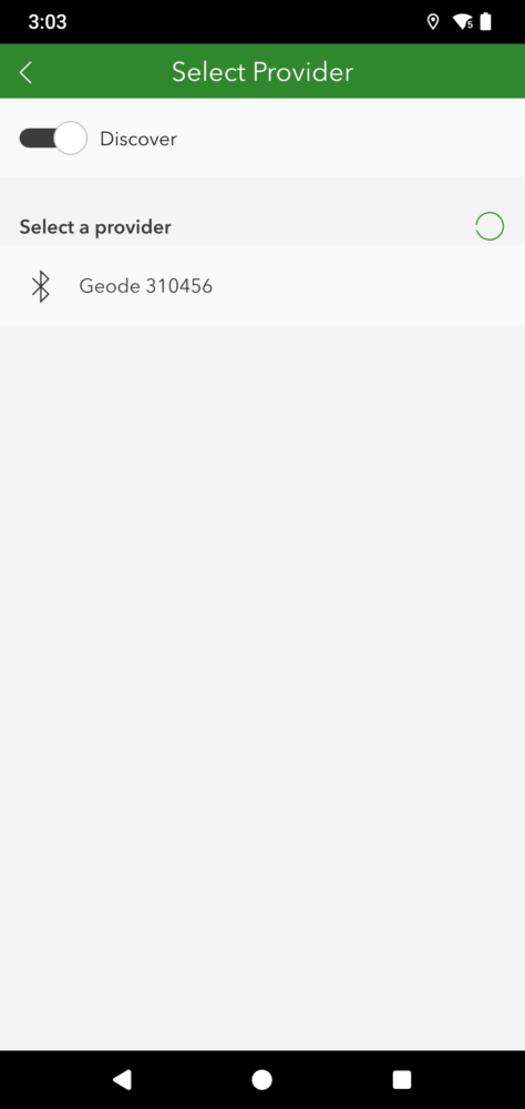
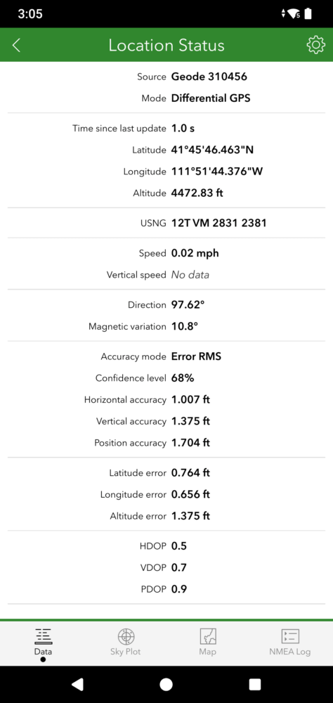
Environmental fieldwork often requires teams to collect detailed information while working in areas with difficult terrain, changing weather conditions, and limited connectivity. The Geode is designed to thrive in these environments by delivering a range of accuracy options for off-grid operations. From submeter with SBAS to sub-foot and decimeter level accuracies with Atlas, and centimeter-level accuracy with Network RTK, the Geode adapts to your accuracy needs. With its rugged design, Bluetooth® connectivity, offline capability, and all-day battery life, field crews can confidently collect location data while using the mobile devices and workflows they already rely on.
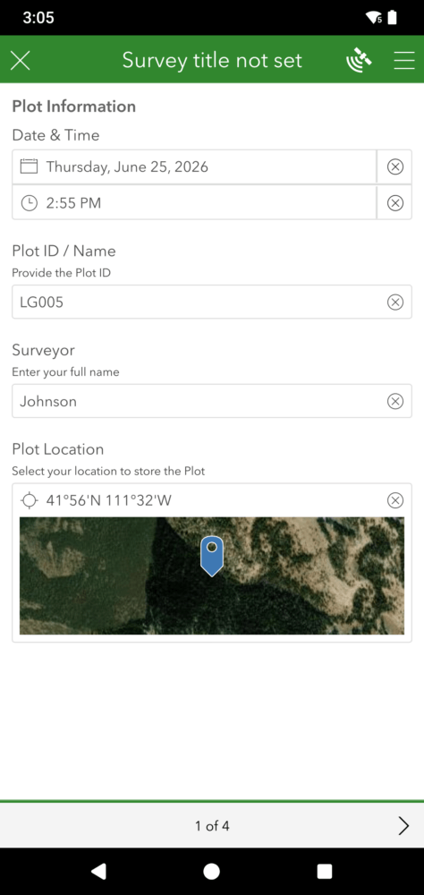
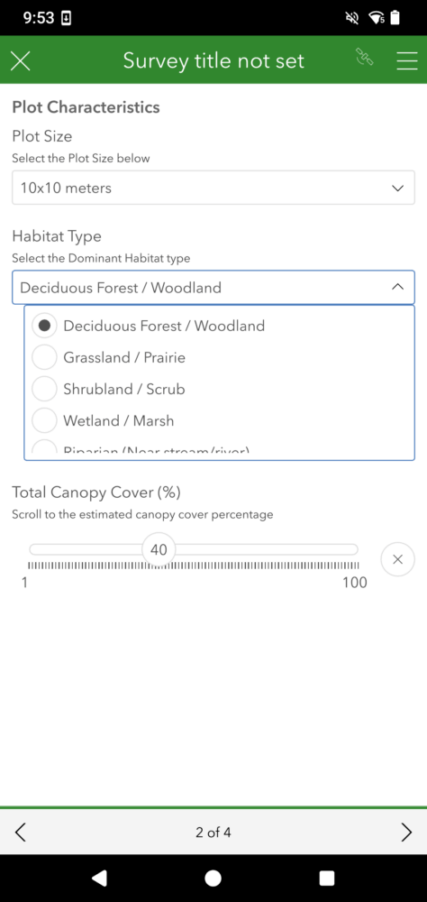
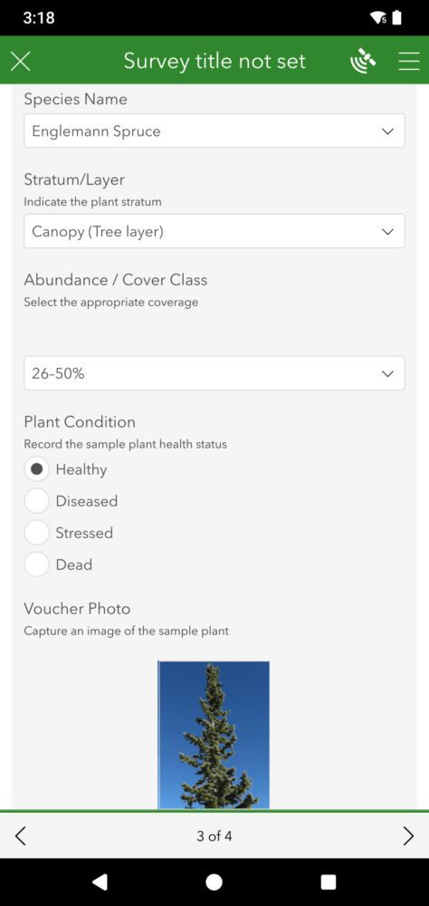
ArcGIS Survey123 complements the Geode by providing an intuitive, form-based GIS data collection app that simplifies how environmental teams gather and manage field information. Survey123 allows users to create customizable forms for collecting environmental observations, inspection details, photos, GPS locations, and other important field data directly from a mobile device. By pairing the Geode with Survey123, organizations can improve the accuracy of collected data while simplifying workflows and reducing manual data entry.
Because the Geode integrates with iPhone®, iPad®, Android™, and Windows 11® devices, environmental professionals have the flexibility to use a wide range of mobile hardware in the field. The Geode also works seamlessly with Juniper Connect, Juniper Systems’ utility app, which allows users to establish a connection to the receiver, configure settings, monitor GNSS status, and deliver location data directly into Survey123. Together, the Geode and Survey123 provide environmental teams with a dependable and easy-to-use solution for collecting accurate field data in a variety of conditions.
How Geode and ArcGIS Survey123 Support Environmental Science Workflows
Environmental science teams rely on accurate and organized field data to support monitoring programs, environmental compliance, conservation efforts, and long-term resource management. Pairing the Geode with Survey123 provides a streamlined workflow that enables teams to capture accurate location data while documenting field observations and inspection information directly from the field. Together, these tools help environmental professionals support workflows such as water quality monitoring, wetland delineation, soil sampling, habitat restoration tracking, vegetation surveys, environmental compliance inspections, erosion assessments and more.
The Geode enhances these workflows by providing reliable GNSS positioning in environments where accurate spatial data is critical for mapping features, documenting sample locations, and revisiting monitoring sites over time. With support for RTK corrections and multiple satellite constellations, environmental professionals can confidently capture precise location data even while working in challenging field conditions. ArcGIS Survey123 complements this capability by providing customizable digital forms that simplify the process of recording field observations, attaching photos, collecting GPS coordinates, and standardizing data collection across teams and projects.
Like the Geode, Survey123 also supports offline data collection, enabling environmental teams to continue working in remote locations without cellular service and synchronize collected information once connectivity becomes available. The Geode’s compact design and wireless connectivity make it easy for field crews to integrate accurate GNSS positioning into their existing workflows without adding unnecessary complexity or equipment. Together, the Geode and ArcGIS Survey123 help environmental science teams improve efficiency, maintain accurate records, reduce manual data entry, and support better environmental decision making through reliable field data collection.
Juniper Systems and Esri: Supporting Environmental Field Operations
Accurate field data plays a critical role in environmental science and resource management. Pairing Juniper Systems’ Geode GNSS receiver with Esri’s Survey123 app provides environmental professionals with a reliable and efficient solution for collecting accurate field information wherever they are. The Geode delivers dependable GNSS positioning that helps improve the accuracy of environmental records, while Survey123 provides the customizable GIS data collection tools needed to streamline inspections, surveys, and monitoring workflows. Whether teams are conducting environmental assessments, documenting restoration efforts, performing inspections, or monitoring natural resources, combining the Geode and ArcGIS Survey123 helps organizations improve the accuracy, consistency, and efficiency of their field operations.