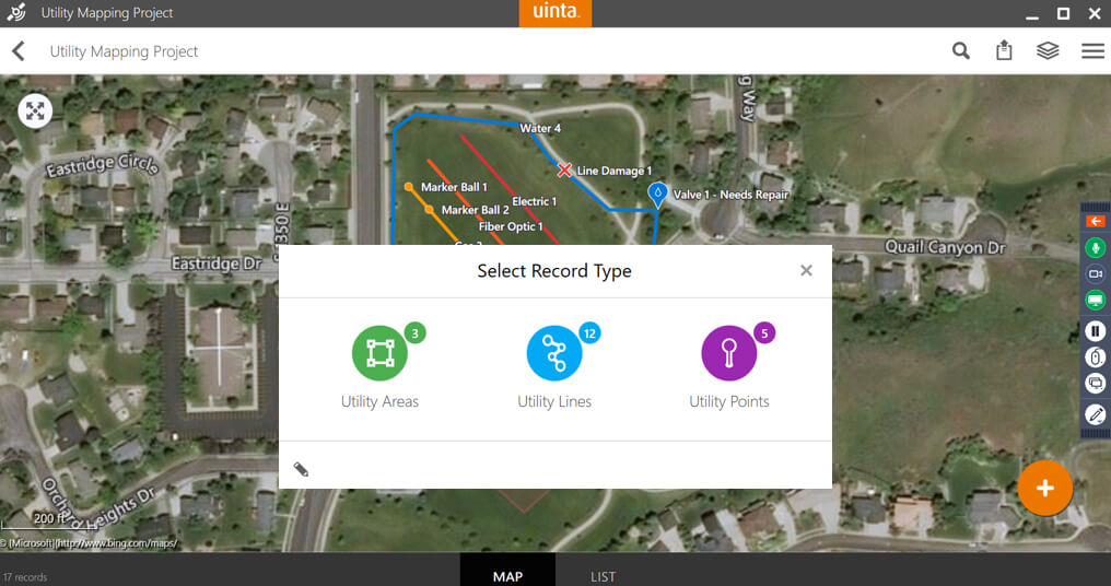
This article offers a quick look at how to create high-accuracy utility maps like a pro without breaking the bank.
There are four main utility locating and mapping challenges that Juniper Systems has identified over the years:
- Paint wears and flags disappear.
- Surveyor mapping is expensive and coordination takes time.
- Expensive GPS equipment and complex software & techniques.
- Data management hassles.
The ultimate solution for utility mapping:
With some of these challenges in mind, Juniper Systems has created a utility mapping software called Uinta. Users can customize the software to meet their needs. The software runs on Windows 10 and will be running on Android soon.
Uinta offers a cloud-based synchronizing option for users. This means that multiple users can work on a large project at once and come together to integrate the data for easy organization. To run Uinta in the field, cellular data or WI-FI are not required. Users can upload projects before going out into the field to get the map layer set. Once this information is downloaded onto the user’s field device, the real-time data collection and mapping can begin.
Getting started for success in the field and office:
To get started, users need a tablet, GPS receiver, and mapping software to get started with utility mapping.
- The Juniper Systems’ Mesa 3 Rugged Tablet comes highly recommended with an IP68 waterproof and dustproof rating, an operating temperature within -4°F to 122°F or -20°C to 50°C, a storage temperature of -22°F to 158°F or -30°C to 70°C, and designed to meet MIL-STD-810G test procedures.

The Geode Sub-meter Receiver from Juniper Systems gives users: sub-meter accuracy, real-time data, all-day battery life, in an all-in-one simple-to-use device.

Using Uinta allows users to apply the information related to utilities to be configurable and easy to use. Depending on user needs, the software can be configured to build numerous templates for a wide variety of jobs. These templates can be grouped into projects for painless organization.

A deeper look at the Uinta Mapping Software:
When a project is created, it can be done in three different ways:
- Device Only: The project is added to the device for a single user. The intent with this way of adding a new project is to share files and to have them reside locally on the device.
- Import Project: Import a full database export. With this method of creating a new project, a file can be selected from your desktop or database to the software for a quick and hassle-free way to share projects through files.
- Cloud-Enabled: Project synchronization for multiple users and devices. Another way to start a project is through a cloud-enabled project. A user would give the project a password and associate it with any map to keep the data secure and visible to the devices the information has been shared with.
For a continued look at Uinta for utility mapping, take a moment to view the full webinar above. The software demo begins at minute 8:04.
Have more questions related to this total solution, check out our utility mapping home page here. For a personal walkthrough of what our devices and software can do for you, then please click the link below.


