Preserving natural resources and being a good neighbor
For Alex Young, GIS manager at the Sonoma Ecology Center in Eldridge, California, accurate mapping and data collection is the key to running a successful environmental non-profit. Young and the team at Sonoma Ecology face many obstacles while trying to maintain the area that many call home. Much of this work revolves around the health of the Sonoma Creek Watershed and its many streams and creeks.
In order to maintain and preserve these creeks and streams, large restoration projects are often conducted. The center’s main issue? The vast majority of land the watershed and its many waterways fall on are privately owned. This is why so much of what the center does revolves around community outreach, education, and collaboration.
For Young, this collaboration with land owners is increasingly important. He is tasked with mapping the area for erosion, sediment, overgrowth, and invasive plants that threaten the watershed and natural ecosystem of the area. It’s important for Young to be able to access these lands and work with landowners to create the best mapped representation of the work that needs to be done.
“We create a lot of data here,” Young said. “We are the ones getting the information out there. Often times, people don’t know what is going on in their own watersheds. By providing data and maps, we educate the public on what the issues are.”
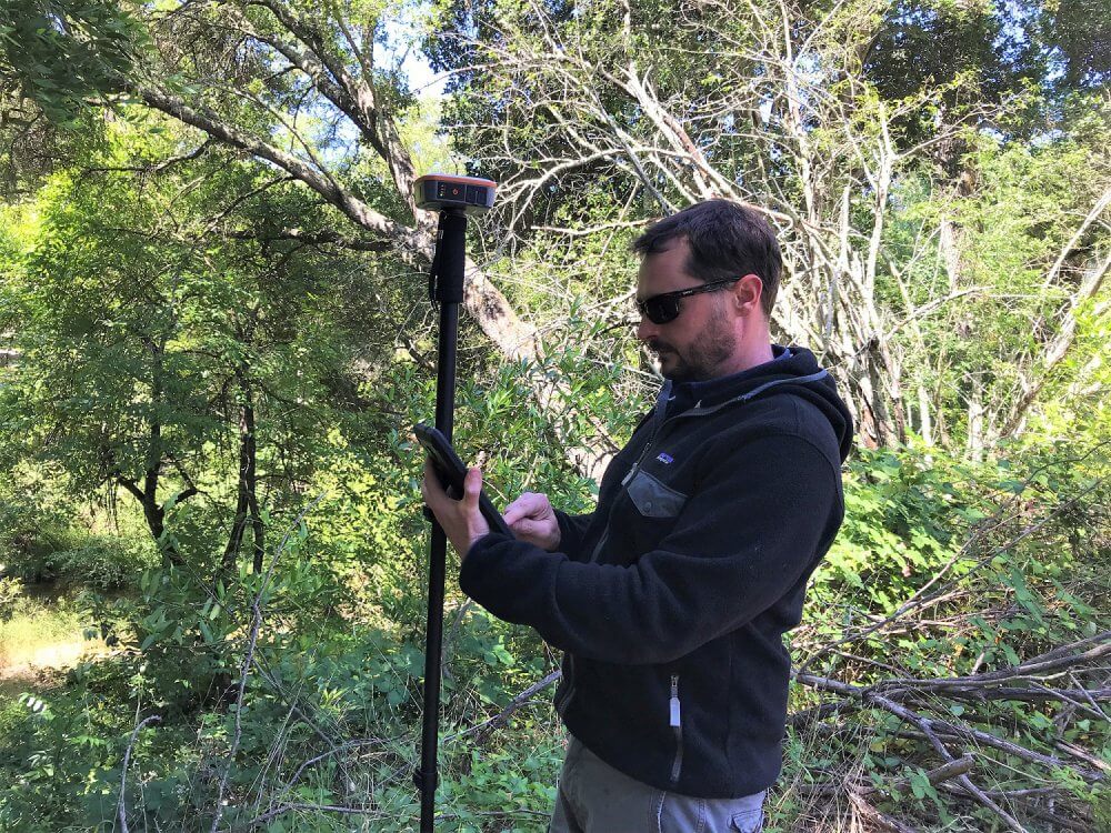
Geode – The go-to device for sub-meter mapping needs
In order to provide this data and reliable maps, Young and his team rely on their Geode Sub-meter GPS Receiver by Juniper Systems. With the Geode, Young and his team are confident the mapping data they are collecting will be effective in assisting crews then tasked with renovation projects and invasive plant eradication. With these maps, they are able to pinpoint locations within sub-meter distances. This gives crews exact locations to focus efforts of clearing weeds, strengthening banks that are eroding, and mapping stream conditions.
Usability and the knowledge that the Geode will just work is important to Young.
“I just love that it works every time,” Young said. “I’m pretty technical. We have restoration crews, sometimes those crews are not that tech-savvy. They just need it to work. If I set it up at the office I know that when I send the crew out that it is going to work.”
Young notes that one task the center has undertaken recently is a result of 2017’s northern California wildfires. These blazes were some of the most devastating wildfires in US history and tore through the Sonoma Valley and across northern California. During post-fire recovery, the area has seen a lot of invasive species of plants take hold in the harsher environment left behind from the fire. Young and his crews have been able to quickly identify and map the areas that are being overgrown with these invasive species and the Geode GPS Receiver has proved invaluable in these efforts.
“We need to have accurate information about where our sites are,” Young said. “Using the Geode, we can get sub-meter accuracy for our crews.”
Discovering the Geode
Young was introduced to the Geode GPS Receiver by Juniper Systems’ partner Brian Mickel from Loggerhead Navigation (LHNav, LLC). Mickel was able to demonstrate to Young the capabilities of the Geode, as well as meet the center’s budget for a new device.
“We’re grant-funded, so we’re pretty price conscious on a lot of things,” Young said. “Brian knows the products so well. We are really glad he had the equipment we needed at a good price – the support’s been great too.”

Young and his team previously used a competing GPS receiver to map and collect data. However, they constantly faced issues with an outdated interface and insufficient memory within the device. With the Geode, Young uses an Android tablet connected via Bluetooth ® . Memory issues and outdated screen sizes no longer hinder their work. Young also uses ArcGIS Collector as his mapping software, which integrates seamlessly with the Geode.
About the Sonoma Ecology Center and Loggerhead Navigation:
The Sonoma Ecology Center, based in Sonoma County, CA, is a non-profit organization that works with community members to enhance the health and sustainability of the ecosystems in the Sonoma Valley area. The Center’s programs include: research, education, preservation, and restoration.
LHNav, LLC is a provider of geospatial instruments and tools for rent or purchase. From meter to centimeter, indoors or out, we have equipment that will help you make your map. Whether your solution is CAD, GIS or something else we can find the right solution or point you in the right direction.