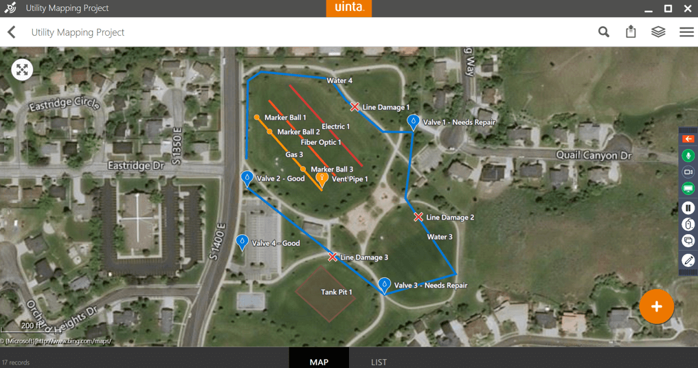
Uinta™ Mapping and Data Collection Software by Juniper Systems offers users a powerful mapping tool that allows for custom and detailed templates to fit even the most unique data collection needs. Users have been enjoying Uinta since its release in 2020. This article takes a closer look at three features that many users have discovered help them gather better and more detailed data while in the field.

Offline Maps
Uinta offers underlying maps to help users better identify elements around them. These maps are easily generated while the user’s device is connected to the internet via Wi-Fi or cellular connections. One feature Uinta users are using is offline maps. Offline maps allow users to clip and download a section of the map right to their device; this file is then used in the field. This is most common when users know they are entering an area without a cellular connection or internet in the area. Uinta offers custom naming for offline map files. Labeling maps allows projects in certain areas to be named appropriately and easily loaded depending on the project.
Below is a short training video showing how to use offline maps in Uinta.
Conditional Logic
Conditional Logic offers organizations a deeper data collecting experience. Best described as an “If this, then that” scenario. As a template is being created, conditions can be set to allow for additional information to be recorded.
For example, a company is using Uinta for water line mapping, management, and maintenance. With Conditional Logic, the water line mapping template can be set up to display additional fields for users to fill out if a valve or other asset is listed as needing repair while inspecting the waterline. These additional fields could include a section for repair notes or ask for a photo to be taken of the item needing repair. If a valve or asset is not marked as needing repair, those additional fields will never be presented to the user doing the work.
Conditional Logic allows for detailed notes to be taken while maintaining a clean form for users to fill out. Below is a training video that shows users how to set up templates, including Conditional Logic. The link is time-stamped to start at the portion of the video that covers Conditional Logic.
Formatting and cleaner maps
Any given job can result in hundreds of points being mapped. Often these points and objects overlap each other. One example is water valves. There could be four or five valves within a few inches of each other. On a map where each valve is represented with a symbol, it is easy for the map to become crowded and hard to read. Uinta has several editing features that allow for data that has been collected and that appears on the map to be cleaned up to provide a better-looking map and allow for easier reading.
These cleaner maps are accomplished through formatting; this includes freely moving labels on the map allowing for stacking. Uinta also has filters that allow users to sort by point type. The example below shows a map that is quite cluttered at first glance. This represents a project that has just been completed, the mapped data is visible using larger pin symbols. The second image is that same project but cleaned up using formatting and smaller symbols to avoid cluttering the map.
Additional Resources
Uinta has many features that allow for users to better collect data while in the field. Juniper recently released an extensive video training series to better help Uinta users learn the many features Uinta offers.
Our experts are available anytime to discuss best practices, offer support, and discuss new ideas for Uinta. Please feel free to reach out to our team with any questions.


