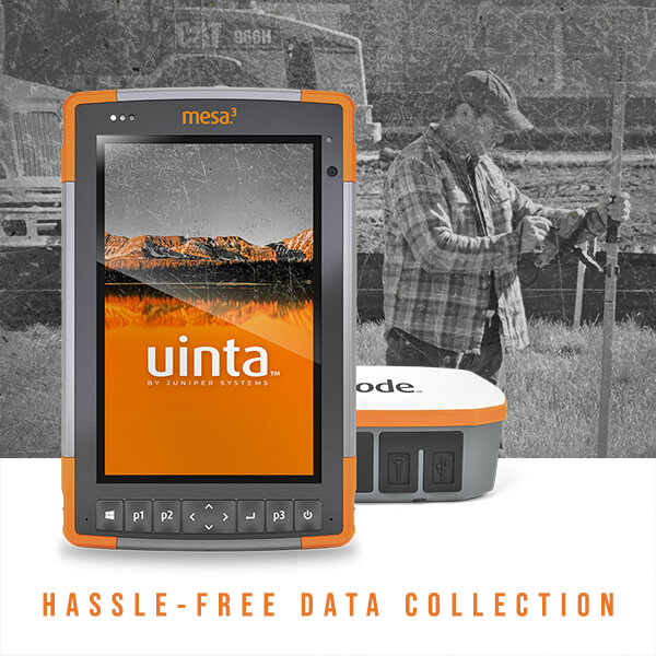
The Uinta total mapping solution by Juniper Systems enables architecture, engineering, and construction (AEC) firms to manage assets, job sites, and resources with exceptional hardware and software. This article demonstrates how the Mesa® Rugged Tablet, Geode™ Sub-meter GPS Receiver, and Uinta™ Mapping and Data Collection Software improves the workflow of professionals in the AEC industry.
A rugged tablet AEC firms use
AEC firms have a variety of needs in a rugged tablet. They work in various environments, from the brightness of the day to the cold and wet conditions of the coastline. In these harsh conditions, it is not uncommon for a tablet to be exposed to dust, water, extreme temperatures, and shock. Users require a tablet that is rock solid and field ready. Creating this type of device for architecture, engineering, construction, and property appraisal requires attention to detail and a clear understanding of the needs of field users.
The Mesa Rugged Tablet is designed for extreme temperature endurance and to be waterproof, dustproof, and shockproof. These features are validated with the following specifications and standards recognized throughout the industry: IP68 rating protecting from water and dust ingression, MIL-STD-810G to withstand shock, vibration, and more.

Choosing a rugged tablet for outdoor work includes many factors to consider. To combat the effects of screen glare or retreating to the shade to view the screen, the Mesa has a large sunlight-readable display. This 7” display uses specialized IllumiView™ technology to provide all users with best-in-class outdoor visibility and clarity without compromising on the graphics.
The Geode Sub-meter GPS receiver that supports AEC needs
Good GPS accuracy for AEC firms is a must. The Geode empowers users with better accuracy. With a powerful sub-meter receiver, the Geode offers greater accuracy for mapping jobs requiring more detail. This level of precision allows users to be more efficient and effective at their job. Users can have confidence in this device as it uses different correction sources to provide accurate and real-time data.
In addition to users achieving greater accuracy in the field, the Geode offers a simple-to-use interface. With only one button on this powerful sub-meter GPS receiver, users can save time with a quick startup and connectivity. This GNSS solution can be used with any of Juniper Systems’ handhelds, an iPhone, iPad, Windows, or Android device.

The open interface focuses on serving users with a diverse set of products and platforms. Juniper Systems understands that those in the AEC industry work hard. This is one of the many reasons why the Geode has an overtime technology battery. An all-day battery supports users looking for a tool that works just as long and hard as they do.
Professionals in the AEC industry continue to be impressed with the ability of the Geode to withstand harsh environments and provide reliable performance.
AEC pain points relieved with the Uinta Mapping Software
Management of information, materials, and the location of assets can be rather difficult. Mapping software can assist management with the organization of this data. Real-time data and communication provide AEC managers with necessary and helpful information to achieve increased productivity. Management and those on-site can easily upload content and have full functionality with Uinta Mapping Software in an offline environment.
Change can be constant in this environment; it can be difficult to maintain up-to-date information to ensure the design and plans can be implemented with optimal timing. Uinta facilitates communication and feedback between those in the field and those in the office. Once information is uploaded, both parties can see the information and become aware of the various circumstances and potential challenges of the field environment.
When a job has been completed or needs additional time, those involved in the project are promptly informed. The timing of this information is critical in order for equipment, supplies, and other assets to be ordered to meet demand. Supply chain managers, architects, and those on-site can communicate in a timely manner to reduce the delay in updates for orders. Those who utilize Uinta no longer need paper and a compass to record maps. The Uinta software can provide relief to those managing the placement of Accessory Dwelling Units (ADU), records, and equipment status.
The all-in-one mapping solution for AEC firms
When the Mesa, Geode, and Uinta are combined, this powerful trio makes for the ultimate solution for those in the AEC industry. A rugged tablet with a sun-light readable display, a long-lasting sub-meter GPS receiver for all-day use, and a customizable GIS mapping software is how Juniper Systems exceeds the expectations of AEC firms.
Contact our experts to learn how this solution can benefit your team.

