West Cedar Creek Municipal Utility District was established in 1975. The municipality in Tool, Texas, is about 45 minutes outside of Dallas. Currently, they serve approximately 35,000 people within a 150 square mile service area with over 4,000 sewer connections and 8,000+ water meters. It takes an entire team to ensure that the water is safe and of the highest quality for this community.
To map, locate, and track each of these pipes for sewer and water, the municipality originally did so with pen and paper. Tony Ciardo, General Manager of West Cedar Creek Municipal Utility District, shared why they upgraded from pen and paper to digital mapping.
“A few years ago, we started directional drilling to put pipes in the ground. We saw a need to map these pipes since there were no ditches to indicate where a pipe had been placed. We considered hiring a surveyor to come out and survey points, but that would have been too costly. It wasn’t an affordable option for us.
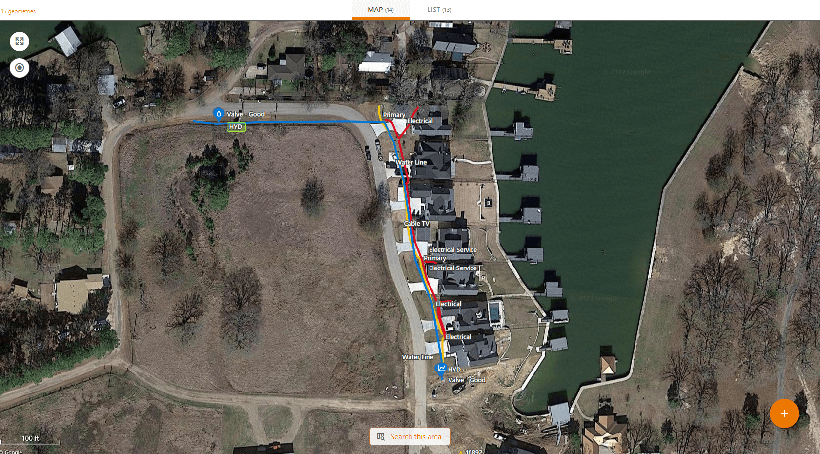
“Uinta came to the rescue as an affordable option for us to map the water or sewer line during installation. The software has been really effective in locating and keeping track of our existing utilities. We use it to map any of the pipes that need repair, are new or old, and our 8,000+ water meters. Uinta has helped us keep track of these lines in a timely and organized fashion,” Ciardo said.

Uinta Data Collection Software is designed to create accurate maps for county water meters, sewer lines, main lines, and more. Providing users with high-accuracy utility asset mapping continues to be one of the most popular ways Uinta is used in the field. Professionals can use a template created by our team of industry experts or create a custom template to complete forms and map assets.
Users can easily create and print professional PDF map reports to include photos and completed work to share with customers. The software was designed with a simple interface for users to begin collecting data in a matter of minutes.

“It’s about time somebody has come up with software that doesn’t take a rocket scientist to use,” Ciardo said. “Uinta is a cut-and-dry software. I can easily build maps and record data within a couple of inches of the pipes. I’m planning on training additional team members to use Uinta.”

In addition to each of these key features, Uinta comes with live and personalized support. High-quality customer service is one of the many ways Juniper Systems differs from competitors.
“The support team has been there for me every single time I have called,” Ciardo said. “In fact, Mike (a Uinta Customer Success Manager at Juniper Systems) called me the other day from home to help me out, and I really appreciated that.”
To learn more about Uinta, please visit the product page or contact our team.

