
Purchasing a GIS mapping software for use in the field and the office is an investment not to be made lightly. This article offers users a quick look at five features to consider when buying GIS mapping software. Thoughts from hands-on users of Juniper Systems’ Uinta™ Mapping and Data Collection Software and the benefits that matter the most to them are also included in this article.
1. Cost
The cost of a mapping and field data collection software is almost always at the top of any user’s list of priorities. At Juniper Systems, this priority was purposefully considered when creating Uinta. There are three affordable license options to choose from.
A 1-year Uinta Pro license costs $500/year and supports use on two Windows 10 devices. These include devices such as an office PC or laptop and the Mesa® 3 Rugged Tablet by Juniper Systems. For teams requiring more than two users, additional users can be added for $250/year.
A 3-year Uinta Pro license is also available for $1,275/3year. This will support the use of two Windows 10 devices. Additional users can be added for $650/3year.
An Organization License can be purchased for teams of 5+ users with options for 1 year, 3 years, and special projects. The pricing details vary depending on the needs of the users. For more information related to this option, click here to get in contact with a Uinta expert.
2. Customization
Uinta allows users to map how and what they want. Customization with this mapping software can be done with the help of Juniper Systems’ customer success team or by users themselves. Either of these options for creating customizations can be done with great ease and speed. Which can give companies and ultimately the users an advantage over the competition with saved time and solutions for each unique workflow.
Users have the option of configuring their very own mapping templates to match the specific job(s) at hand. When users are given the ability to customize data entry forms, it can better reflect the hard work taken place in the field. The attention to detail that users can implement with customizable areas, maps, lines, points, colors, and so much more can seem endlessly helpful.

Julie Polasik, Wildlife Ecologist with Alder Environmental shared the following, “We have been highly impressed with the accuracy of the software for mapping areas, lines, and points and recommend it to anyone looking for a versatile field mapping software.”

Juniper Systems’ customer success team supports a wide range of industries to create the ideal data collection solution for each unique workflow. The templates created by our industry experts are free, quick to set up, and easy to use in the field or at the office for managing data.
For example: See how Uinta is being used in the commercial irrigation industry.
3. Ease of Use
Mapping and managing data can be a tough task to accomplish. Having a data collection software that works both offline and connected online makes it easier for assets to be recorded and viewed later on. Once assets and data are mapped it can be difficult to sort through all of the information gathered. With an advanced filtering system, that challenge can be fixed with a few simple clicks.
Uinta maps allow users to quickly sort and filter data points and assets with ease. Having the ability to view background satellite imagery offline or online is a feature that makes it so users can identify and recall when and where assets were documented.
That seems like a lot of features to learn. Luckily, Uinta is also user-friendly. The simple interface allows users to be trained and collecting data in minutes. Advanced features are right at their fingertips and reporting data that is collected has never been easier.
Matt Bellman, from Sweetwater Utility Exploration, said this about Uinta, “I wasn’t sure how quickly my guys would be able to pick up being able to use it but so far they have all gotten really good with it in about a day or so. The way this thing is working out we will need to add another unit soon.”
4. Connectivity
Whether users are in the field or the office, their mapping software needs to work for them. Uinta is as powerful in the office as in the field. Online and offline functionality offers flexibility to users. Currently, Uinta is supported on Windows 10 devices. Uinta will be launching for Android devices at a later time.
Uinta is a powerful mapping and data collection tool. Using a Windows 10 device, Uinta can draw GPS data from either the device’s internal GPS or from an attached external GPS receiver. This gives users the flexibility and accuracy they need. If the internal GPS of a Windows 10 device provides enough accuracy for the job at hand money can be saved by not purchasing an external receiver. Those looking for high accuracy mapping can turn to an external GPS receiver, such as the Geode™ Sub-Meter GPS Receiver to meet their needs.

5. Support
Last, but not least is user support. This is where Juniper Systems stands out among the competition. Once Uinta software is purchased and being utilized by the user, there is more to be accomplished. Users will often have questions about templates for download, updates, system maintenance, and more.
That being said, Juniper Systems offers world-class live support for free to any Uinta user. Our in-house team of experts can answer questions or concerns that may come up. This is one of the many perks of working with the Juniper team as everything from manufacturing to post-sales support is done under one roof.
Sara Bryant, Project Manager at Beacon Energy, shared the following about working with Juniper Systems’ products and team, “The customizable software makes reporting so easy and clean! I especially appreciate that I can change the user interface in my office in Long Beach and my employees can sync their tablets and have the needed changes in seconds no matter where they are. The few times I’ve needed to call for support the issue has been resolved immediately and I NEVER talk to a robot, only live and instant support.”
The total package

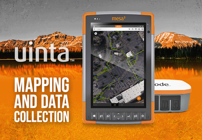
Uinta is the complete solution for mapping in practically any industry from utilities to industrial asset inspections. Uinta combined with a Mesa Rugged Tablet and Geode Sub-Meter GPS Receiver make for the ultimate mapping and data collection solution. To learn more about Uinta click here.
If you have more questions and would like a personal walkthrough of what Uinta, the Mesa, and Geode can offer you, then please click here.